This page includes information about popular maps and guidebooks for hiking in Idaho. Topics are organized as follows:

Maps and Atlases
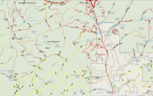
- Benchmark Maps. Idaho recreation map: public lands, Idaho Centennial Trail, Boise, Sun Valley, and Coeur d’Alene vicinity maps. Scale 1:833,333. Medford, Oregon: Benchmark Maps, various years. – Benchmark
- Bureau of Land Management (BLM) Surface Management Maps. These maps show whether land is private or public, and what part of the government has jurisdiction. You can also download apps that include this information.
- DeLorme Mapping Company. Idaho atlas & gazetteer. Scale 1:250,000. Freeport, Maine: DeLorme Mapping, various years. – Rand McNally
- Metsker
- Big Sky
- USGS Topographic Maps – These maps are published by the United States government and are available in a variety of formats. Read more about topo maps here.
- Geographic Information Systems (GIS) are mapping systems that allows computers to map geologic data. Many downloadable maps use GIS. GIS can be used in conjunction with the Global Positioning System (GPS) which uses a network of satellites to locate positions. GPS can be used with cellular telephones, automobiles, and specialized GPS devices.
- Idaho Trails Map, Idaho Department of Parks and Recreation
- Idaho Trail Conditions – Take pictures, and comment on Trail Conditions.
- Recreation in Idaho: Campgrounds, Sites and Destinations. Bureau of Land Management.
- Idaho Public Room, Bureau of Land Management

Trails
- Hiking in State Parks, Idaho Department of Parks and Recreation.
- Idaho Trails Map, Idaho Department of Parks and Recreation
- National Historic Trails, National Park Service
- National Recreation Trails in Idaho, American Trails
- National Scenic Trails, National Park Service
- National Trails System Web Map – This map is not for navigational purposes, but gives an overview of the National Trails System.
California National Historic Trail
The California Trail cuts through the south east corner of Idaho, breaking from the Oregon Trail at Fort Hall, where it heads toward Nevada.
- California National Historic Trail, Bureau of Land Management
- City of Rocks National Reserve, National Park Service
Continental Divide Trail
- Continental Divide Trail Coalition
- Howard, Lynna; photography by Leland Howard. Montana and Idaho’s Continental Divide Trail: the official guide. Englewood, Colo.: Westcliffe Publishers, 2000.
- Wolf, James R. Guide to the Continental Divide trail. Missoula, Montana: Mountain Press Pub. Co., 1976, 1986.
- Pern, Stephen. The Great Divide: a walk through America along the Continental Divide. New York: Viking, 1987, 1988. 1st American ed.
- Berger, Karen; and Daniel R. Smith. Where the waters divide: a walk along America’s Continental Divide. New York: Harmony Books, 1993.
- Devitt, Michael J. Divide by two wheels: racing a mountain bike unsupported, 2,700 miles from Canada to Mexico on the Continental Divide. Morrisville, North Carolina: Lulu Publishing, 2017.
- McCoy, Michael; and the Adventure Cycling Association. Cycling the Great Divide: from Canada to Mexico on North America’s premier long-distance mountain bike route. Seattle: Mountaineers Books, 2013. 2nd edition.
Idaho Centennial Trail
In 1990, the Lasting Legacy Committee of the Idaho Centennial Commission designated the Idaho Centennial Trail (ICT) the official trail of Idaho. The trail is usually hiked from south to north starting in the desert near the Idaho-Nevada border and ending at the border with British Columbia, Canada. The trail crosses private and public land and is considered challenging.
- Idaho Centennial Trail Blog, Idaho Department of Parks & Recreation
- Idaho Centennial Trail digital map, Idaho Parks & Recreation
- About the Trail. Idaho Parks and Recreation. (PDF) https://parksandrecreation.idaho.gov/sites/default/files/uploads/documents/centennialtrail/Centennial%20guide%20pdf.pdf. Accessed December 17, 2018.
- Centennial Trail Map. Idaho Parks and Recreation. https://parksandrecreation.idaho.gov/activities/hiking/centennial-trail/. Accessed October 25, 2022. – Shows the basic route with viewable 1:500,000 DeLorme maps.
- Crancer, John; directed by Chuck Cathcart. Outdoor Idaho. Idaho’s Centennial trail. Idaho Public Television. Boise, Idaho: Idaho Public Television, 2006.
- Idaho Public Television, John Crancer, producer, and Chuck Cathcart, director. Outdoor Idaho. Idaho’s Centennial trail. Boise, ID: Idaho Public Television, 2006.
- Stuebner, Stephen, and The Idaho Trails Council. Discover Idaho’s Centennial Trail. Boise, Idaho: Boise Front Adventures, 1998.
- Whittaker, Ron. The search for the flat ness monster. Bloomington, IN: AuthorHouse, 2015.
Ice Age Floods National Geologic Trail
- Ice Age Floods, National Park Service
- Ice Age Floods Institute
- Ice Age Floods National Geologic Trail: Draft Foundation Statement. National Park Service, U.S. Geological Survey, Bureau of Land Management, Bureau of Reclamation, U.S. Fish and Wildlife Service, U.S. Army Corps of Engineers, and the U.S. Forest Service. September 2011. https://www.nps.gov/iafl/learn/management/upload/IAFL_FD_SP.pdf
- Ice Age Floods: Study of Alternatives and Environmental Assessment Following the Pathways of the Glacial Lake Missoula Floods. Funded by the National Park Service through its Special Resource Study Program. Produced by Jones & Jones Architects and Landscape Architects. Seattle, Washington. February 2001. Complete book PDF) https://purl.fdlp.gov/GPO/gpo149897. Web page: https://www.nps.gov/iceagefloods/.
Lewis and Clark Trail
The Lewis & Clark Trail passes through Idaho from Lolo Pass to Lewiston.
- Lewis & Clark Trail, National Park Service
- Fanselow, Julie. The traveler’s guide to the Lewis & Clark Trail. Helena, Montana: Falcon Press, 1994.
- The double eagle guide to camping along the Lewis and Clark Trail. Lewis and Clark Bicentennial ed. Billings, Montana: Discovery Pub., 2004.
- Schmidt, Thomas. The Lewis & Clark Trail. Bicentennial ed. completely rev. Washington, D.C.: National Geographic, 2002.
Nez Perce Nee Me Poo National Historic Trail
The Nee-Me-Poo trail crosses Idaho north of the Lochsa River before heading down the continental divide to Yellowstone National Park. The trail follows the historic route used by the Chief Joseph’s band of Nez Perce during the 1877 Nez Perce war, as they fled their home in Oregon, to Yellowstone National Park, and north through Montana toward Canada.
- Nez Perce National Historic Trail, Bureau of Land Management
- Nez Perce National Historic Trail, U.S. Forest Service
- Nez Perce Trail Foundation
- Nez Perce National Historic Park, National Park Service
Oregon Trail
Interstate 84 roughly follows the route of the Oregon Trail through the Snake River Plain in Idaho.
- Oregon National Historic Trail, National Park Service
Pacific Northwest Trail
One hundred miles of the Pacific Northwest National Scenic Trail (which starts in Glacier National Park and finishes at Cape Alava on the Olympic Peninsula) reside in Idaho. The PNT traverses the Kootenai and Idaho Panhandle National Forests as well as the Priest Lake State Forest. Highlights include the crossing of the Moyie and Kootenai Rivers and the Selkirk Mountains.
U.S. Geological Survey and Forest Service maps may not provide enough information about this trail, but the Pacific Northwest Trail Association provides maps, and information about apps and guidebooks.
- Pacific Northwest Trail Association (PNTA)
- Pacific Northwest Scenic Trail, U.S. Forest Service – includes maps and other information.
- Strickland, Ron. Pacific Northwest trail guide. Seattle, Washington: Writing Works, 1984.
- Townsend, Chris. Grizzly bears and razor clams: walking America’s Pacific Northwest Trail. Dingwall: Sandstone Press, 2012.

Greenbelts and Railroad Trails
- Idaho Rail to Trail, VisitIdaho.org
- “Existing Rails to Trails Conversions in Idaho as of August 2017.” Idaho Transportation Department. https://itd.idaho.gov/library/bike/rails-trails-idaho.pdf. Accessed December 17, 2018.
- TrailLink, Rails-to-Trails Conservancy – This nonprofit provides a downloadable app.
- Bartley, Natalie L. Best rail trails. Pacific Northwest: more than 60 rail trails in Washington, Oregon, and Idaho. Guilford, Connecticut: FalconGuides, 2015. Second edition.
- Existing Rails to Trails Conversions in Idaho as of August 2017 (PDF), Idaho Transportation Department
- Boise Greenbelt
- Garden City Greenbelt
- Eagle Greenbelt
- Caldwell greenbelts map, Idaho Press Tribune
- Friends of the Coeur d’Alene Trail
- Friends of the Weiser River Trail
- Idaho Falls River Walk
- North Idaho Centennial Trail, City of Coeur d’Alene
- Route of the Hiawatha, Lookout Pass

Hiking Guidebooks
- Recreation in Idaho: Campgrounds, Sites and Destinations. Bureau of Land Management.
- Ridge to Rivers. Ridge to Rivers Trail System: Shafer Butte trails.Boise, Idaho: Ridge to Rivers, 2012. Ridge to Rivers
- Aegerter, Mary; and Steve F. Russell. Hike Lewis and Clark’s Idaho. Moscow, Idaho: University Press of Idaho, 2002.
- Barstad, Fred. Best hikes near Spokane. Guilford, Connecticut: FalconGuides, an imprint of Globe Pequot Press, 2014.
- Barstad, Fred. Best hikes Spokane: the greatest views, lakes, and rivers. Guilford, Connecticut: FalconGuides, 2018.
- Barstad, Fred. Hiking Hells Canyon and Idaho’s Seven Devils Mountains. Guilford, Connecticut: Falcon Pub., 2001.
- Bartley, Natalie L. Best easy day hikes, Boise. Guilford, Connecticut: Falcon, 2010.
- Bjornstad, Bruce N; and Eugene Kiver. On the trail of the Ice Age floods: the northern reaches: a geological field guide to northern Idaho and the Channeled Scabland. Sandpoint, Idaho: Keokee Books, 2012.
- Bluestein, S. R. Exploring Idaho’s high desert: a guide to non-motorized recreation on Idaho desert-character public lands with outstanding wild, natural, scenic, historical, and recreational values. Boise, ID: Challenge Expedition Co., 1991. 2nd ed.
- Dykes, Fred W. Jeffrey’s Cutoff: Idaho’s forgotten Oregon Trail route. Pocatello, Idaho: F.W. Dykes, 1989.
- Fuller, Margaret, and Jerry Painter. Trails of eastern Idaho. Weiser, Idaho: Trail Guide Books, 2001. 2nd edition, revised and updated.
- Fuller, Margaret. Trails of western Idaho. Weiser, ID: Trail Guide Books, 2003. 3rd edition, updated and expanded.
- Fuller, Margaret, and Jerry Painter. Trails of eastern Idaho: 103 backcountry trails for hiking, biking, and horseback riding. Weiser, Idaho: Trail Guide Books, 2010. 3rd edition, revised and updated.
- Hiking hot springs in the Pacific Northwest. Helena, Montana: Falcon, various years.
- Hiking Oregon’s Eagle Cap Wilderness. Helena, Montana: Falcon Press, 1996.
- Hollingshead, Anne, and Gloria Moore. Day hiking near Sun Valley: with wildflower lists for nearby mountain regions. Ketchum, Idaho: Idaho Conservation League, 1995. Rev. ed., 12 new hikes added.
- Jackson, Sally. Hiking Hot Springs in the Pacific Northwest… Descriptions of more than 80 scenic hikes to or starting at more than 140 hot springs in Idaho, Washington, Oregon, and British Columbia. [S.I.] : Falcon Guides, 2014.
- Landers, Rich, and the Spokane Mountaineers, with maps by Helen Sherman.100 hikes in the inland Northwest. Seattle: Mountaineers, 1987.
- Linkhart, Luther. Sawtooth National Recreation Area: a guide to trails, roads, and waters in Idaho’s Sawtooth, White Cloud, and Boulder mountains. Berkeley: Wilderness Press, 1988/1992.
- Marchant, Scott. Best easy hikes greater Boise: 50 hikes within two hours of Boise. Boise, ID: Hiking Idaho, 2018.
- Marchant, Scott. The day hiker’s guide to Stanley, Idaho: 46 hikes within 30 miles of Stanley, Idaho. Boise, Idaho: Hiking Idaho, 2009.
- Marchant, Scott. The day hiker’s guide to Sun Valley & Ketchum: 50 hikes within 30 miles of Sun Valley, Idaho. Boise, Idaho: Hiking Idaho, 2010.
- Marchant, Scott. The hiker’s guide Idaho’s Sawtooth country: 60 hikes in the Sawtooth, White Cloud and Salmon River Mountains. Boise, Idaho: Hiking Idaho, 2015.
- Marchant, Scott. The hiker’s guide McCall & Cascade: 65 hikes near McCall and Cascade. Boise, Idaho: Hiking Idaho, 2017.
- Marchant, Scott. The hiker’s guide to McCall & Cascade: 55 hikes near McCall, Idaho. Boise, Idaho: Hiking Idaho, 2011.
- Marchant, Scott. The hiker’s guide: Greater Boise. Boise, Idaho: Hiking Idaho, 2012.
- Moore, Gloria. Day hiking near Sun Valley. Sun Valley, Idaho: Gentian Press, 2002. Revised edition, Fourth edition.
- Moore, Gloria. Easy hiking near Sun Valley. Sun Valley, ID: Gentian Press, 1997.
- O’Brien, Mike; and Jim “Yeti” Fulmis. Idaho boundary trail hikers guide 2018. San Bernadino, California: Createspace/Idaho: Fultek, 2018.
- Painter, Jerry. Backcountry hiking & biking trails in the Idaho Falls area. Idaho Falls, Idaho: Post Register, 1993.
- Phillips, Roger. Hiking and angling in McCall. McCall, Idaho: Lizard Prints Publishing, 2000.
- Potucek, Martin. Idaho’s historic trails: from Lewis and Clark to railroads. Caldwell, Idaho: Caxton Press, 2003.
- Sandpoint Ranger District, United States Forest Service. Sandpoint Ranger District trails. Sandpoint, Idaho: USDA Forest Service, Northern Region, Idaho Panhandle National Forests, Sandpoint Ranger District, 1996?
- Stilwill, David, and Rob McDonald. The trail book: Sun Valley and the surrounding area. Hailey, Idaho: Peak Media, 1995.
- Stilwill, David, Rob McDonald, and Shawn Carkonen. The trail book: Boise and the surrounding area. Hailey, Idaho: Peak Media, 1995.
- Stuebner, Stephen, and Mark Lisk. The Owyhee canyonlands: an outdoor adventure guide. Boise, Idaho: Boise Front Adventures, 2013.
- Stuebner, Stephen, and The Idaho Trails Council. Discover Idaho’s Centennial Trail. Boise, Idaho: Boise Front Adventures, 1998.
- Stuebner, Stephen. Boise trail guide: 95 hiking & running routes close to home. Boise, Idaho: Boise Front Adventures, 2018.
- Trail of the Coeur d’Alenes unofficial guidebook: and the 300k Bitterroot Loop. Spokane, Washington: Gray Dog Press. 2015.
- Wild Horse Studio, illustration and design. Oregon Trail in Idaho: and other emigrant trails. Boise, Idaho: Idaho Travel Council: Idaho State Bureau of Land Management, 1992.
- Zoner, Aria. The Idaho soaktennial trail: a soaker’s rendition of the classic route. California: Aria Zoner, 2015.
Hot Springs
- Adventure Cycling Association. Idaho hot springs mountain bike route: main route map: Idaho City, Ketchum, Stanley, McCall. 2014. Scale: 1:250,000. Missoula, Montana: Adventure Cycling Association, 2014.
- Hiking hot springs in the Pacific Northwest. Helena, Montana: Falcon, various years.
- Jackson, Sally. Hiking Hot Springs in the Pacific Northwest… Descriptions of more than 80 scenic hikes to or starting at more than 140 hot springs in Idaho, Washington, Oregon, and British Columbia. S.I.: Falcon Guides, 2014.
- Roloff, Doug. Complete guide to Idaho hot springs. Idaho: Doug Roloff, 2013. 2nd edition.
- The hiker’s guide to hot springs in the Pacific Northwest. Helena, Montana: Falcon, various years.
- Waters, Susan K. Exploring magical McCall & more: 46 day hikes, & hot springs, waterfalls, historical sites, Crystal Mountain, Chinese Cemetery, Mountain Garden, fabulous Discovery Drive, the mystery of Loon Lake story. McCall, Idaho: Susan K. Waters, 2007. Revised vol. 3.
- Zoner, Aria. The Idaho Soaktennial Trail: a soaker’s rendition of the classic route. California: Aria Zoner, 2015.
Mountain Biking Guides
- Adventure Cycling Association. Idaho hot springs mountain bike route: main route map: Idaho City, Ketchum, Stanley, McCall. 2014. Scale: 1:250,000. Missoula, Montana: Adventure Cycling Association, 2014.
- Devitt, Michael J. Divide by two wheels: racing a mountain bike unsupported, 2,700 miles from Canada to Mexico on the Continental Divide. Morrisville, North Carolina: Lulu Publishing, 2017.
- Fuller, Margaret, and Jerry Painter. Trails of eastern Idaho: 103 backcountry trails for hiking, biking, and horseback riding. Weiser, Idaho: Trail Guide Books, 2010. 3nd ed., rev. and updated.
- McCoy, Michael; and the Adventure Cycling Association. Cycling the Great Divide: from Canada to Mexico on North America’s premier long-distance mountain bike route. Seattle: Mountaineers Books, 2013. Second edition.
- Mountain Bike Opportunities, Bureau of Land Management.
- Painter, Jerry. Backcountry hiking & biking trails in the Idaho Falls area. Idaho Falls, Idaho: Post Register, 1993.
- Ridge to Rivers, Boise, Idaho
- Ridge to Rivers. Ridge to Rivers Trail System: Shafer Butte trails. Boise, Idaho: Ridge to Rivers, 2012.
- Stone, Lynne. Adventures in Idaho’s Sawtooth Country. Seattle: Mountaineers, 1990.
- Stuebner, Stephen. Mountain Biking in Boise. Boise, Idaho: Boise Front Adventures, 2002.
- Zilly, John, and Eloise Christensen. Mountain bike adventure guide: for the Sun Valley area. Ketchum, Idaho: John Zilly, 1989.
- Zilly, John. Son of the mountain bike adventure guide. Ketchum, Idaho: Adventure Press, 1992.
Winter Trails
- Idaho: Nordic Skiing/Snowshoeing. VisitIdaho.org
- Watters, Ron. Winter tales and trails: skiing, snowshoeing and snowboarding in Idaho, the Grand Tetons and Yellowstone National Park. Publisher, Date: Pocatello, Idaho: Great Rift Press, 1998.
- Year-round yurt and trail guide: Idaho City area trail system: complete winter and summer trail maps. Boise, Idaho: Idaho Department of Parks and Recreation, 1998.
Related Pages
This page updated by Ronnie Joiner on June 3, 2019.