• Skip to primary navigation
  • Skip to main content
  • Skip to primary sidebar

FARRIT

Finding All Resources Relating to Idaho Topics

  • About FARRIT.Lili.org
    • Contact Us
    • Home
  • Agriculture
    • Camas
    • Dams, Hydroelectric Power, and Irrigation
      • Columbia River Treaty
    • Farming
    • Gardening
    • Livestock Brands
    • Rangeland
  • Books
    • Authors
    • Idaho Book of the Year Award
    • Idaho Writers-in-Residence
    • Popular Idaho Memoirs
    • Recommended Idaho Books
    • Telephone Companies and Directory Publishers
  • Business
    • Business Research
    • Starting a Business in Idaho
    • NonProfit Research
    • Starting a NonProfit in Idaho
  • Collections
    • Digitized Publications on FARRIT
    • Digitized Maps on FARRIT
    • Digitized Publications on FARRIT
    • Government Documents
    • Guide to Digital Archives
    • Idaho Collections
    • Museums
  • Design
    • Architecture
    • Dams, Hydroelectric Power, and Irrigation
  • Environment
    • Climate Change
    • Environmental Maps
    • Environmental Regulation and Cleanup
      • Environmental Impact Statements (EIS)
      • Formerly Used Defense Sites (FUDS)
    • Dams, Hydroelectric Power, and Irrigation
      • Columbia River Treaty
      • Teton Dam Disaster
    • Fire
    • Salmon
    • Wildlife
    • Food
      • Agriculture
      • Beer, Wine, & Liquor
      • Gardening
    • Water
  • Food
    • Agriculture
    • Beer, Wine, & Liquor
    • Gardening
    • Natural Resources
  • Genealogy
    • Census
      • Census Data
      • Census Records
    • Cemeteries
    • Census Records
    • Newspapers
    • Obituaries
    • Telephone Companies and Directory Publishers
  • Government
    • Elections and Voting
    • Government Documents
    • Idaho Government
    • Idaho Women’s Conference
    • Reapportionment and Redistricting
  • Health
    • Novel Coronavirus (COVID-19) Pandemic
    • Environmental Regulation and Cleanup
  • History
    • Idaho Women’s Conference
    • Internment of Japanese Americans
    • Land Acts
    • Lewis & Clark and the Corp of Discovery
    • Mining History
    • Memoirs & Journals of Western Expansion
    • Native American Treaties
    • Oregon Trail
    • Reapportionment and Redistricting
    • Ruby Ridge Standoff
    • Sheep and Cattle Wars
    • Teton Dam Disaster
    • Wars and Battles of Idaho and the West
  • Land
    • Land Acts
    • Land Resource Maps
    • Native American Treaties
    • Natural Resources
    • Property Research
    • Water
  • Law
    • Legal Resources
    • Native American Treaties
    • Water
  • Maps
    • Aerial Maps
    • Environmental Maps
    • GIS Mapping
    • Insurance Maps
    • Land Resource Maps
    • Political Maps
    • Topographic Maps
  • Natural Resources
    • Climate Change
    • Fur Trade
    • Gardening
    • Mining
      • Mining and Prospecting
      • Mining History
    • Native American Treaties
    • Plants
      • Camas
      • Weeds
    • Rangeland
    • Water
      • Dams, Hydroelectric Power, and Irrigation
        • Columbia River Treaty
        • Teton Dam Disaster
      • Watershed
    • Wildlife
  • People
    • Abigail Scott Duniway
    • African Americans on the Frontier
    • Authors
    • Chinese People in Idaho and the West
    • Genealogy
    • Immigrant Stories
    • Internment of Japanese Americans
    • Lewis & Clark and the Corp of Discovery
    • Mary Hallock Foote & Arthur De Wint Foote
    • Memoirs & Journals of Western Expansion
    • Notable Idahoans
    • Oregon Trail
  • Places
    • Census Data
    • Dams, Hydroelectric Power, and Irrigation
    • Formerly Used Defense Sites (FUDS)
    • Historic Airstrips and Airports
    • Maps
    • Place Names
    • Post Offices
  • Recreation
    • Bicycling
    • Roads
    • Sporting Life
    • Trails
  • Science
    • Archaeology and Paleontology
    • Environmental Regulation and Cleanup
    • Environmental Maps
    • Geology
    • Natural Resources
    • Science Databases
    • Wildlife
      • Salmon
  • Transportation
    • Aviation
    • Historic Airstrips and Airports
    • Bicycling
    • Oregon Trail
    • Railroads
    • Roads
    • Trails
You are here: Home / Maps / Insurance Maps

Insurance Maps

Flood Insurance Rate Maps (FIRM)

The most widely distributed flood map is the Flood Insurance Rate Map (FIRM). It is produced and distributed by the Federal Emergency Management Agency.

Flood risk information presented on FIRMs is based on historic, meteorologic, hydrologic, and hydraulic data, as well as open-space conditions, flood control works, and development. To prepare FIRMs that illustrate the extent of flood hazard in a flood prone community, FEMA conducts engineering studies referred to as Flood Insurance Studies (FISs). Using information gathered in these studies, FEMA engineers and cartographers delineate Special Flood Hazard Areas (SFHAs) on FIRMs.

SFHAs are those areas subject to inundation by a flood that has a 1-percent or greater chance of being equaled or exceeded during any given year. This type of flood is referred to as a base flood. A base flood has a 26-percent chance of occurring during a 30-year period … the length of many mortgages. The base flood is a regulatory standard used by Federal agencies, and most states, to administer floodplain management programs, and is also used by the National Flood Insurance Program as the basis for insurance requirements nationwide.

A variety of information can be found on FIRMs, including:

  • Common physical features, such as major highways, secondary roads, lakes, railroads, streams, and other waterways
  • Special Flood Hazard Areas
  • Base (1 percent annual chance) flood elevations or depths
  • Flood insurance risk zones
  • Areas subject to inundation by the 0.2 percent annual chance flood
  • Areas designated as regulatory floodways
  • Undeveloped coastal barriers

The Boise Public Library has FIRM’s for Ada and Boise County, Boise City and Twin Falls. Check Boise Public Library’s catalog for holdings. These maps are on the 3rd floor of the Main Library and must be used in the library.
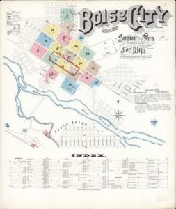
Sanborn Fire Insurance Map from Boise, Ada County, Idaho. Sanborn Map Company, Jan, 1893. Map. https://www.loc.gov/item/sanborn01569_003/.

Sanborn Fire Insurance Maps

Fire insurance maps are detailed city plans, usually at scales of 50 or 100 feet to an inch. They show individual building “footprints,” complete with construction details such as building material (brick, adobe, frame, etc.), height (of larger buildings), number of stories, location of doors, windows, chimneys and elevators, use of structure (dwelling, hotel, church, etc.), street address, and occasionally the ethnicity of the occupants. Other features shown include lot lines, street widths, water pipes, hydrants and cisterns, and fire-fighting facilities.

The maps were originally produced for insurance underwriters who used them to determine risks and establish premiums. Today these maps are used by scholars and researchers in such fields as history, urban geography, architectural history and preservation, ethnic studies, and urban archaeology.

Sanborn maps are available on microfilm at the Idaho State Archives. Search WorldCat using the terms sanborn fire insurance maps idaho to find additional holdings in libraries. They are available in microform, print, or in ProQuest’s Digital Sanborn Maps 1867-1970.

The Library of Congress has an extensive collection of Sanborn Maps. Some Idaho maps are digitized.


This page updated by Ronnie Joiner 5/1/2018.

Primary Sidebar

LiLI Services

LiLI Databases - access magazine articles free

Other Resources

TumbleBooks of the Day
DaybyDayID.org Storytimes OnlineSay YES to TBS

Search Our Site

Scout Video Collections

Scout Video Collections

scout.lili.org

This website and program are brought to you by the Idaho Commission for Libraries and made possible, in part, by the Institute of Museum and Library Services (IMLS).

Institute of Museum and Library Services Idaho Commission for Libraries

Top | Log in