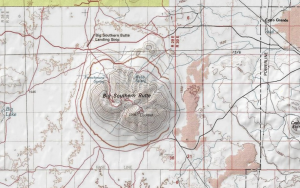
Topographic maps are among the most widely used of all maps. Their most distinguishing features are the contour lines that show the shape and elevation of the land. Topographic maps also show both natural and man made features, including mountains, valleys, rivers, vegetation, roads, boundaries and major buildings.
Computer technology has changed the way maps are made and used. Digital Raster Graphics (DRG) are scanned images of the USGS topographic maps. Like printed maps, DRGs can be purchased from the USGS. In addition, there are websites that make these maps available on the Internet. Some of these sites are listed here:
- Department of the Interior, U.S. Geological Survey: USGS Store
- The U.S. Geological Survey (USGS) produces topographic maps for the entire United States. The best known maps are the 1:24,000-scale maps known as 7.5 minute quadrangle maps. Each maps covers an area of 7.5 minutes of longitude. In addition to the 7.5 minute maps, USGS also produces complete topographic coverage of the U.S. at scales of 1:100,000 and 1:250,000.
- Inside Idaho is a clearing house for digital geospatial data made available by the University of Idaho Library.
- Trails.com features topographic maps for the entire U.S. which can be searched by place names instead of quadrangle names.
- NASA WorldWind
- Public Lands Information Center provides virtual maps of Idaho’s Public Lands.
- Boise State University’s Albertsons Library has a collection of topographic maps for all the 50 states.
- Boise Public Library has a collection of Idaho USGS topographic maps (7.5 minute quadrangles) and a selected collection of Idaho topographic maps (1:100,000 scale) produced by the Idaho Department of Transportation.
- The Idaho State Archives have USGS topographic maps for Idaho (15 and 7.5 minute series.)
- The Idaho Geologic Survey provides easy to use map indexes on their web page in addition to their extensive collection of mapping tools and digital data.
- The USGS Geographic Names Information Service can help you identify maps using specific search criteria.
- Access historic topographic maps using the National Geologic Map Database
GUIDES
- Table of Land Measures/Land Description Diagram (PDF) – How to read Public Land Survey System Township and Range information. Includes information on Township and Range. More information about the Public Land Survey System is available from the National Map.
- USGS Map Scales (PDF) – USGS Fact Sheet 015-02, February 2002
- USGS Topographic Map Symbols (PDF) – This guide covers USGS-USDA Forest Service Single-Edition Quadrangle maps, Provisional-Edition maps, and Topographic Bathymetric maps.
This page updated by Ronnie Joiner December 31, 2022.